


San Michele trail
IL SENTIERO DI S. MICHELE
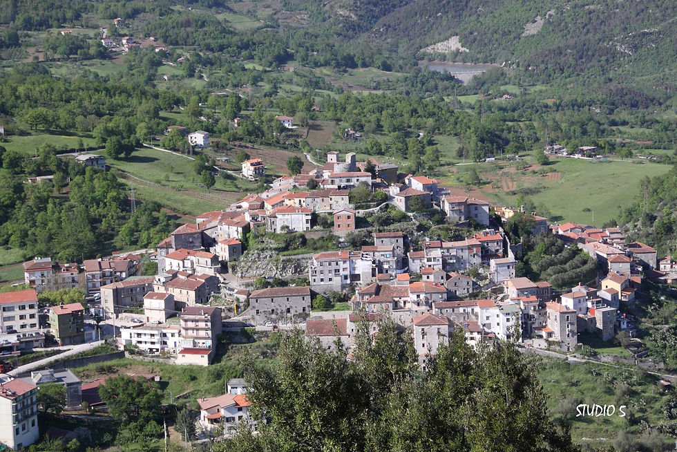
The ancient village of Caselle credit foto: STUDIO 5

The path of San Michele credit foto: STUDIO 5

Devoti in processione alla grotta di San Michele. Devotees in procession to the cave of San Michele. Credit foto: STUDIO 5
The ancient village of Caselle credit foto: STUDIO 5
Un itinerario molto caro al popolo casellese, perché parte integrante della religiosità popolare, è quello che conduce al Monte Pittari o San Michele (690 m) dalla piazzetta omonima del centro abitato.
In 40 minuti si raggiunge il punto più alto per una strategica visione dell’intera valle.
Sul percorso le iniziali pietre calcaree (l’etimologia del loro deriva infatti da Pietraro), lasciano spazio a grotte ed arbusti fino ad un prato che conserva tracce di un’antica abbazia medievale, per giungere infine ad un largo da dove si può osservare il golfo di Policastro fino alla costa calabra.
Qui si aprono le due grotte che ospita il santuario dedicato a San Michele Arcangelo, raffigurato in un pregevole bassorilievo del XII secolo, accessibili tramite un ingresso in muratura costruito nel settecento.
Il culto dedicato al principe degli angeli, molto diffuso in tutta l’area è espressione suggestiva di un cristianesimo introdotto dai monaci bizantini giunti in gran numero sulle coste meridionali italiane sin dal V-VI secolo.
Insediatisi tradizionalmente in anfratti montani in luoghi solitari, i religiosi divennero riferimento prezioso per le comunità locali. Poi il sentiero passa sul versante est della montagna assecondando la corona rocciosa e aprendosi su scorci panoramici di rara bellezza. Passando a ridosso di antichi suggestivi speroni rocciosi si può godere del volteggio planato di importanti rapaci. L’esplorazione del sito non può trascurare le grotte del Tavaniello e dell’Occhio Nero e la gobba del Colle Serra (690 m), i cui rinvenimenti archeologici testimoniano come l’area costituì il primo nucleo abitato della zona. Consigliate estensione del percorso si congiungono al sentiero che in mezz’ora arriva alle gole di Morigerati dove risorge il Bussento.
This route is very important to the people of Caselle as an essential part of local religipus practice. It leads to Mount Pittari or San Michele (690m.) from the square of the same name in the town center. In 40 minutes, we come to the highest point for strategic view of the entire valley.
On the route, limestone rocks at the beginning (the place's etymology comes from Pietraro, based on the word for stone), give way to the busches and caves, up toa field that holds the remains of an old medieval abbey. It then comes to a clearing from which we can see the Gulf of Policastro to the Calabrian coast.
At this point are the openings of two caves that hold the sanctuary dedicated to st. Michael the Archangel, depicted in a fine 12th-century bas relief, that can be accesed through a stone entrance built in the 18th-century.
Worship of the "prince of angels" is very widesperead throughout the area. It is a fascinating expression of Chistianity introduced by byzantine monks who flocked to Italy's soutern coasts starting in the 5th and 6th centuries. The monks traditionally settled in mountain ravines and solitary places and became invaluable resources for local communities. The trail then continues on the eastern slope of the mountain, following a rocky ring and opening on scenic views of uncommon beauty. Passing by picturesque, ancient rocky cliffs, we can admire the acrobatic flights of birds of prey. An exploration of the area is not complete without the caves of Tavaniello, Occhio Nero and the hump of Colle Serra (690 m.), whose the site of the first local settlement. Sggested continuations of the route link to the trail that is a half from the gullies of Morigerati where the Bussento River re-emerges.